
7 July 1870
- Description
-
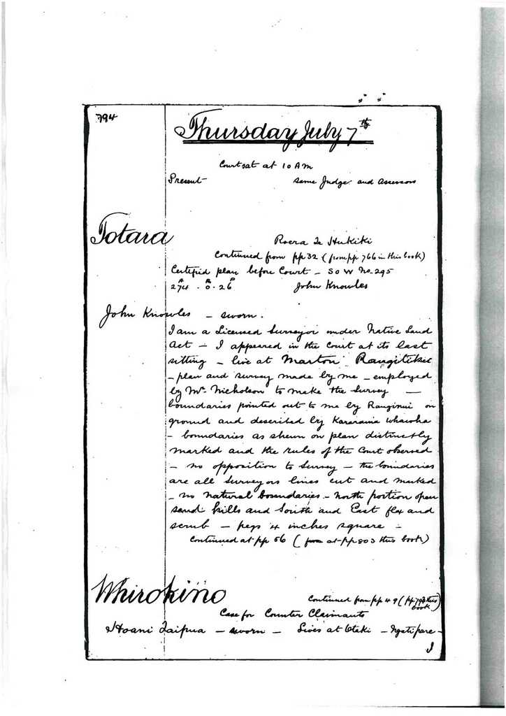
Thursday July 7th
Court sat at 10 am.
Present – same judge and assessors.
Totara – Roera Te Hukiki
Continued from pp 32 (from pp 766 in this book).
Certified plan before court – S. O. W No. 295 – a274 – r0 – p26 – John Knowles.
John Knowles – Sworn
I am a licensed surveyor under Native Land Act. I appeared in the court at its last sitting. Live at Marton, Rangitikei. Plan and survey made by me. Employed by Mr. Nicholson to make the survey. Boundaries pointed out to me by Ranginui on ground and described by Kararaina Whawha. Boundaries as shown on plan distinctly marked and the rules of the court observed. No opposition to survey. The boundaries are all surveyors lines cut and marked. No natural boundaries. North portion open sand hills and south and east flax and scrub. Pegs 4 inches square.
Continued at pp56 (at pp 803 this book).
Whirokino – case for counter claimants
Continued from pp 49 (pp 793 this book)
Hoani Taipua – Sworn
Lives at Otaki. Ngatipare. I object to the claim of Mary Jane Cook to the land shown on the plan before the court. This land does not belong to her but to Ngatipare. I say that this is not her land ‘ko tetahi take’ because of its having been let by Ngatipare to Mr. Thos Cook by Ngatipare. I don’t know what year it was let to his nephews at his request. Another reason is this. When Ngatiraukawa first came from Maungatautari to this place the ‘hapu’s went to seek for land for themselves on the coast. The ‘hapu’s of Ngatihuia and Ngatipare and Te Roera’s ‘hapu’ to Wairarawa – south of this claim. Te Here saw the Koti Kotinga o te whenua and that the land claimed was assigned to Ngatipare. They then went in land. Other ‘hapu’s had other places ‘i roto o Manawatu’ assigned to them. This land is part of that assigned to Ngatipare. After this they came back and ‘noho ki whirokino’ ‘he tauranga waka’. They ‘mahi tuna’ at the lakes kaikai and got flax. They occupied and ‘whaiauau i runga i tenei whenua’. They after ‘whaka noho Ngati Kauhata ki ana roto mahi – ka tukua mai ki te mahi tahi’. Ria Te Haukoraki will speak to this. After this Ngatipare returned to Otaki and the produce of this land was brought to them at Otaki by those who remained on the land and by Ngati Kauhata. After this some of Ngatipare returned ‘ki uta o Manawatu ki te tiaki ano I nga whenua i reira mo tenei whenua’. After this, a woman of Ngatipare ko Hine nui i te po was ‘whakamoe ki te pakeha’ (Skipwith) and Ngatipare then said let sheep be taken to the land the subject of enquiry. The sheep were taken to the land of which this claim is a portion. Te Rangihaeata heard and went ‘ki te atiati i aua hipi mo Ngatihuia hoki’. His was “he riri pokanoa’ – ‘Kahore ia i pai ki te pakeha kia noho ki nga whenua katoa o Ngatiraukawa’. He went to Porotawhao. That is a place inland about 4 or 5 miles south of the lakes kaikai and Otaki and Karaitiana (my father) were the chiefs of Ngatipare who were at Manawatu taking care of the lands of Ngatipare with their wahines Ria (my mother) and Merata. They had a row with Rangihaeata. He was ‘kaha’ and prevailed and the sheep were taken away. The sheep were taken away to the Himatangi to Parakaia’s land. No other ‘hapu interfered with Ngatipare in respect of this land. Ngatikikopiri was not heard of. It was only Rangihaeata at that time ‘takiwa ka whakaritea e Ngatipare tetahi hapu ki te mahi i nga tuna o nga roto o te whenua katoa. Ngatitera – they were to get the eels and the Ngatipare were to have them brought to them at Otaki. That ‘hapu’ Ngatitera was related to Ngatipare as was Ngati Kauhata also. That was one reason why the arrangement was made. It was after Ngati Kauhata left that Ngatitera was told to get the eels. Te Rakaherea was “te tangata nui o taua hapu’. He is dead but ‘tona tangata’ – Te Koroheho and Tatana and Maika of that ‘hapu’ are the persons who now get the eels of that place. I know of no one who opposes their eel pa or their hinaki’s up to the present time. The eels are still brought to us to ‘nga mea e ora ana o Ngatipare’ if they like.
Mr. Cook came to my ‘tuakana’ (Te Matenga, self – Hoani, Ropata Te Ao Marere, Te Moroati Kiharoa also Te Roera for this potion as of another tribe and the rest of us) and asked us to let it to his ‘iramutu’ and we leased it. We received the rents. This was about 5 years back. After this Cook asked for a lease on his own account. He came to us. We leased to him and one reason or our doing so was that a half caste relation of ours formed an attachment to one of Cook’s sons by Mere and we let the land as a run for sheep of this son. We received rent from Cook. Cook’s sheep were seized and he ceased to pay rent. After this Albert Nicholson applied to us for a lease of the land and we leased it to him. I produce a document relating to the lease to him. The boundaries of this lease includes the land claimed by Mary Cook except that portion of it where the east boundary is turned to include the Otai bush.
(Document put in purporting to lease certain lands to Albert Nicholson dated January 1st 1869).
The survey of Mary Cook has been made without reference to any ownership. The land north of the north boundary belongs to Ihakara and south of that to Moroati and Te Matenga. The land was assigned to different individuals at the first apportionment spoken of by me.
Thomas Cook – Sworn
Reside at Foxton, Manawatu. A settler. I know the land shown on the plan before the court. I did apply to you and Ngatipare including Merata widow of Otaki for a lease of the land the subject of the claim for my nephews. So far as I know the boundaries of the land I sought to lease were those shown in this plan. I believe this was about 8 or 9 years ago. On my nephews giving up the lease, I applied to the same parties Ngatipare and Moroati for a lease on my own account. About 6 years, my nephews held it 2 or 3 years. Merata was the widow of Otaki who was a Ngatikikopiri. The names in the document of that lease were the same as those in the lease to Mr. Nicholson with the addition of Merata’s name. Mary Jane’s name was not in the document because she knew that Otaki’s widow should receive rent during her life. Otaki was a near relation of my wife’s. Merata’s name was inserted by the natives not by me. I considered that Otaki was the owner of the land. It was Otaki who invited me to come to Manawatu in about 1842 and when I was married to Mrs. Cook. He was living with us. It was he who let Skipwith’s sheep on the land. The counter claimants were children at that time. When Rangihaeata was driven from the Hutt to Porotawhao he heard of these sheep and got them sent away. Otaki hearing of Rangihaeata’s intention sent to Ngatipare to come to resist Rangihaeata and his 50 men. None of them came but Karaitiana was at Manawatu. He and his wife and my wife’s relatives and Otaki and myself were the persons who met Rangihaeata and we kept the sheep on the ground all day in opposition to Rangihaeata’s party who sought to drive them off. At night, Otaki, after talking the matter over consented to the sheep being sent away. After this Otaki lived with us for about 2 years and accidentally shot himself. I had him taken down the river and sent for a doctor – paid £7. He died but previous to his death he turned to Karaitiana and said “I leave my land to my son Kipa and to my iramutu” meaning my children by the claimant Mary Cook. After his death Otaki was buried on the land – grave shown. This was done to prevent Ngatihuia and those who acted with Rangihaeata from claiming the land. His own wish was to have been buried at Otaki but by the wish of his relatives he was buried at Whirokino for the reason given. His daughter is also buried there and two of my children. This was about 20 years ago. Merata came to receive a portion of the rent paid by me for the land. On her death the portion of the rent was received by my wife. I did not apportion the rent but Ngatipare and she had a portion. When I gave up the run it was let to Mr. Nicholson by the same parties excepting Merata who was dead. I showed him my lease and pointed out to him that Merata’s name was one of the parties and told him that my wife represented her. On hearing that rent had been paid, my wife applied to Nicholson and was referred by him to Hoani Taipua who put her off and at last told her that they could not recognize her claim and she then asked me to assist her in getting the land surveyed in order to prove her claim.
Hoani Taipua – recalled for Xexamination.
At this stage of proceedings the claimant asked permission to withdraw the claim.
Claim withdrawn by permission of court.
Fee demanded from claimant Hearing £1
Court adjourned at 1 pm.
Court resumed at 2 pm.
Hukuwai No. 4 and 5
Continued from pp 34 (continued from pp 770 this book)
G. F. Swainson – recalled – sketch survey before court.
I went on to the land included in this claim on Tuesday July 5th with the opposing claimant. The principal opponents were Parakaia, Moroati, Kiharoa and Ropata Te Ao. Ropata put in the pegs of the portion he claimed and which I have shown in the sketch before the court. I put in a sketch on a larger scale of the south west and south east boundary – (produced). The claim of Ropata is pegged off by him as shown on the new sketch colored green also shown on the original sketch. Moroati’s claim is the portion colored red on the new sketch. A triangle shown on the sketch AB – BI – IA. The distance from B to I would be about 1 chain. It is 42 links on Ropata’s line. Both these conflicting claims encroach upon the claim before the court. I then went with Parakaia to see the boundaries of the land claimed by him. He showed me the point marked C on the original sketch. His boundary goes from C to I shown on original sketch. It is a survey of Mr. Hughes – the subject of a claim by him brought before the court which was dismissed. I think the land was called Rekereke. Parakaia stated that the plan of that claim is in possession of the court. I then went to south east boundary – from A to the ngaio (on new sketch). After some discussion between Ngatipare and Ihakara on one side and the claimant on the other they appeared to come to an understanding to accept the line claimed by Tiemi Ranapiri as a give and take line.
Continued at pp 58 (at pp 806 in this book).
Rangihiwinui – Nerehana Te Paea
Case called – No appearance.
Letter put in from Nerehana stating that he is unable to attend court.
Hearing adjourned to future sitting.
Certified plan before court S. O. W No. 288 – 111 acres – James Thomson sent to deputy inspector January 27th 1870.
Mr. Thomson – Licensed surveyor appeared to give evidence as to survey.
Plan referred to him to except land granted and to correct area.
Hearing of case adjourned to a future sitting.
Totara
Continued from pp 50 (pp 794 this book)
Roera Hukiki appeared and applied for an adjournment of hearing to future sitting. Stating that Nerehana’s claim to Rangihiwinui conflicts with his also that Hoani Taipua who was absent was a counter claimant.
Hearing adjourned accordingly.
Te Rerengaohau – Ihakara Tukumaru and another
Claimant appeared.
Certified plan before court S. O. W 300 – 1226 acres – James Thomson.
Ihakara Tukumaru – Sworn
Lives at Foxton, Manawatu of Patu Kohuru ‘hapu’ of Ngatiraukawa. The description in the application is not mine. My claim is bounded on the south by Te Moroati’s land (not by land of “Mary Jane Cook”). Witness traces other boundaries as given in application. The persons interested in this land are those named 3 persons (A).
(A)
Ihakara Tukumaru, Ema Ihakara, Ruanui Tukumaru
Mo te karauna enei i roto i tenei mapi. (The interest of Hokepera is only through me. She is a child of my deceased sister). I apply for a grant in favor of the persons named. Ema is my wife and Ruanui is my ‘teina’. We claim this land as land occupied by Te Patu Kohuru on our coming here before Haowhenua and occupied since. These are the hapu’s who have given up their joint interest in this land to me. There are cultivations of mine on the east side of that. Shown , river. I have a house at Te Rerengaohau. It is a wooden house built by me. There is a road across this land but not as shown on this plan. It is the road from Foxton to the beach but the road in use lies to the east of that shown on the plan. The one shown on the plan has not been used. I object to it as a line or road.
Objectors challenged – None appeared.
Court adjourned at4 pm till tomorrow.
Identification
Related items


Creation
- Created By
Object rights
- License
- Attribution + Noncommercial + ShareAlike