
24 March 1868
- Description
-
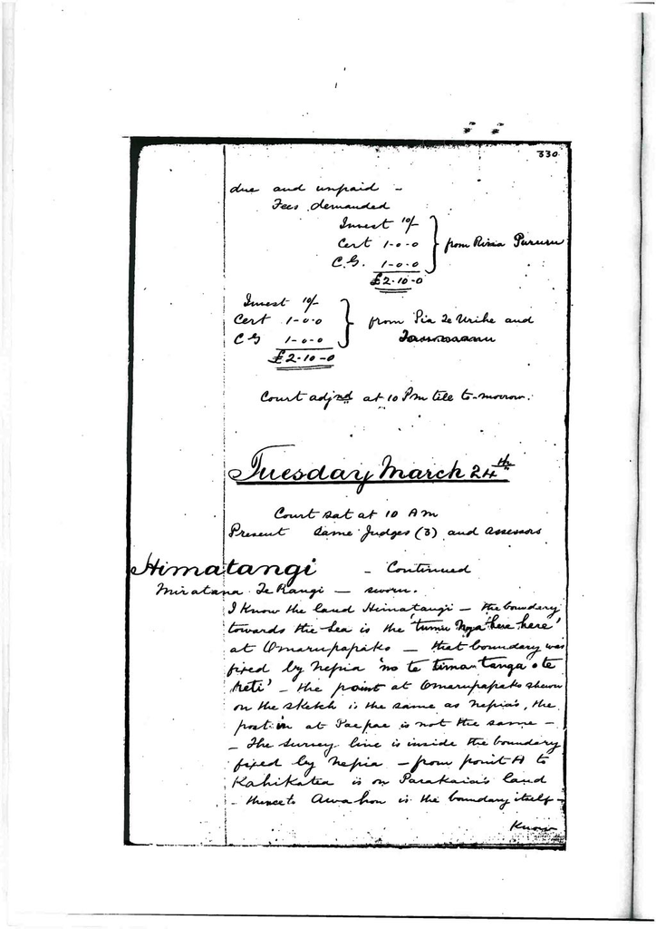
Page 330
Tuesday March 24th
Court sat at 10am
Present same judges (3) and assessors
Himatangi – continued
Miratana Te Rangi – sworn
I know the land Himatangi – the boundary towards the sea is the ‘Tumu nga herehere’ at Omarupapako – that boundary was fixed by Nepia ‘mo te timatamga o te reti’ – the point at Omarupapako shown on the sketch is the same as Nepia’s, the post in at Paepae is not the same – the survey line is inside the boundary fixed by Nepia – from point H to Kahikatea is on Parakaia’s land – thence to Awahou is the boundary itself –
Page 331
Know the Awahou boundary – the land outside that boundary is Parakaia’s and Paratene’s on one side, on the other it is Nepia’s and Hare Hemi’s – the boundary was to mark the land of Parakaia and the land of Hare Hemi above and below the Kahikatea – know the boundary between this land and Ngatikauhata’s land – commences at Whitirea goes towards Paepae – 4th boundary is Manawatu river – my ‘hapu’ has no land within the boundaries – but I cultivated there – it was long ago at the time of conquest – I cultivated 2 years and ceased – ‘mutu tonu atu’ went to Rangitikei and on Manawatu to Haumiaroa on the land sold to the crown by Ihakara – I have no land at Himatangi because I became possessed of land at Rangitikei – Himatangi was left to Paratene and Parakaia and their ‘hapu’s’ – I know of no other ‘hapu’s’ besides those 3 – Ngati Rakau Ngati Te Au and Ngati Turanga before Dr. Featherston’s money was paid at Parewanui the Ngati Raukawa were for keeping the land and not selling –
Paereira Te Mahirahi – Ohau – Te Korehe – Ngati Raukawa know the land at Himatangi being investigated – know the boundary next to sea – Nepia and Parakaia fixed it – it is marked by Kahikatea – I was not present but
Page 332
Have seen the Kahikatea fixed as the ‘rohe’ – Parakaia told me that was the boundary also Hare Hemi – I know the surveyors line – it cuts off a chain of Parakaia’s land the boundary at the Kahikatea – Parakaia told me that the portion of his land cut off by the survey line would be given up by him to Hare Hemi , [Tounihi] and others – this boundary was marked before the money was paid at Parewanui – know the boundary at Te Awahou – know the boundary dividing it from Ngati Kauhata land – it commences at Whitirea and goes towards Paepae but stops short of Paepae – Manwatu is the inland boundary – the land in these boundaries belong to Ngati Turanga Ngati Rakau and Ngati Te Au – I have no land nor my ‘hapu’ from the commencement of the occupation these ‘hapu’s’ only own – have not heard that Ihakara has any land there before the payment of Dr. Featherstone’s money at Parewanui – all Ngatiraukawa and most of the chiefs were apposed to the sale of the land –
Cross examined by Mr. Fox – I am not a chief of Ngatiraukawa – a man of Ngatiraukawa – I and all the people heard – I am not a chief. Did not go to all meetings – the majority of the people and chiefs were non-sellers at the time of payment of money at Parewanui – sellers told
Page 333
Me – I live at Otaki it is perhaps about 16 miles from Himatangi – often go there – the people who live at Himatangi live along the bank of Manawatu and catch eels
Cross examined by Mr. Williams – at the payment of money at Parewanui some of the Ngati Kauhata were at Otaki some at Oroua – none of them went to Parewanui – only the sellers went – the majority of Ngati Kauhata and of Ngati Te Ihi Ihi were ‘kai pupuri’ – Paraniha Te Onepuahu and part at Otaki
Akapita Te Tewe – sworn Otaki Te Mate Awa Ngatiraukawa knows the land investigated – know the boundary on the side towards the sea – it was settled by Nepia – I did not see the putting in of the
Page 334
Posts but they were shown to me by Nepia when we went to Rangitikei – Nepia told me that it was a ‘rohe tuturu ki a Parakaia’ and the side to the sea was for Hare Hemi and himself (Nepia) know the ‘rohe pou’ now marked boundary as pointed out to me by Nepia – (shows difference by sketch)
There is a Kahikatea near the intersection of these lines – I was shown the Kahikatea from a distance did not go up to it – the south boundary was fixed when the Awahou block was sold – boundary goes from Whitirea towards Paepae – land on the
Page 335
Other side belongs to Ngati Kauhata and Ngati Te Ihi Ihi – the 4th boundary is the rivewr of Manwatu – I believe exclusively to the 3 ‘hapu’s’ Ngati Rakau – Ngati Turanga and Ngati Te Au – I know of no other ‘hapu’ as owners
Kooro Te One – [unknown word] Know the land subject of investigation – know boundaries – my ‘hapu’ has land adjoining – the boundary is from Whitirea and thence towards Paepae – I have heard there have been disputes between our tribes and Parakaia beginning in 1834 – Whitirea is close to Manawatu river – it is a ‘pukepuke’ – don’t know the year when it was fixed but it was settled by Mr. Williams to terminate disputes between Ngati Kauhata – Ngati Te Ihi Ihi – and Ngati Turanga – it was agreed to as a ‘rohe tuturu’ from Whitirea on towards Paepae – the boundary I heard which was first talked of was from Whitirea to a Kahikatea tree – Mr. Williams had fixed but at another part of Whitirea and thence to Otupere near the sea – this was arranged by us only – it was not agreed to by Parakaia’s people
Page 336
In 1866 the boundary shown on the sketch
Was fixed – all did not consent to this – I and Te Reihana only of Ngati Kauhata agreed – in 1857 we marked off the boundary to Otupere – the 3 ‘hapu’s’ were angry and came to us – Nepia and Ihakara and other chiefs of Ngatiraukawa came in 1858 and the boundary was then fixed to be from Whitirea to Otupere – Paratene and his wife agreed to Whitirea and Otupere, but not to the intermediate[unknown word] they wanted the ‘rohe’ to go to the Kahikatea and to another point instead of going straight – we wished to have the line straight – the
Page 337
Intermediate points were left unsettled – only the points at each end were fixed – Ngapuketurua and the Kahikatea were the points not settled – after 1861 the boundary was shifted to Paepae on account of the lease to Mr. Robinson – from Paepae to Ote Atatuhi a hill and thence to Whitirea that boundary was accepted as the boundary of the lease ans was left, but the boundary of the land was from Whitirea to Otupere – in the year 1866 – Parakaia came with his surveyor – we did not go with him to arrange that boundary – he did not send us word – we heard and sent for Parakaia to come and talk with us about it that we might go together to arrange boundary – when they came to us the survey had been completed – I and Te Reihana at last consented – Ngati Kauhata now all agree to that line as a boundary – (the non-sellers I mean) – know another of the boundaries shown to me on the plan – I know south boundary – the boundary next to the queens land – know the boundary at the south end is a Kahikatea tree – between a small bush and Omarupapako bush – have been to other end of boundary and think it is not in a straight line with
Page 338
Paepae – at this end there is a ‘pou’ of Parakaia’s – as far as I know it is only a ‘pou’ put in for the purpose of survey – the land between these boundaries belong to Ngati Rakau, Ngati Turanga and Ngati Te Au – I have never seen Ihakara or Patu Kohuru in occupation – I live at Oroua – I live at Puketotara and at places on the Oroua – I am after about Himatangi – never saw Patu Kohuru living there – I was born at Otaki about 1839 – went to Oroua when young – never saw Patu Kohuru there
Court adjourned at 10.45 pm for 1 hour
Court resumed at 1.45pmHenare Te Waiatua – sworn Oroua – Ngati Rangi of Ngatiraukawa – know the land and the boundary on the Ngati Kauhatu side – commences at Whitirea and goes thence to Otupere – this is an old boundary – the boundary now agreed to is from Whitirea to Paepae – I know the boundary settled by Mr. Williams formerly – it commenced at Whitirea thence to Ngapuketurua – it went straight to Ngapuketurua – I was present at the fixing of that boundary – Ngapuketurua is a hill – points out on plan – Mr. Williams settlement of boundary – Te Kooro disputed
Page 339
With Parakaia – know the boundary between this land and the Queens land at Te Awahou – don’t know the seaward boundary – have heard of it did not go there – I now live at Rangitikei at Taonui in the Oroua – I only heard about the seaward boundary – the land within these boundaries belongs to Ngati Te Au Ngatirakau and Ngati Turanga – never saw Patu Kohuru there
Cross examined by Mr. Fox – when the talk of the Rangitikei Manawatu block began I went to Oroua – I don’t own Himatangi – have not lived at Himatangi – am a chiefWiriharai Te Angiangi – sworn
Know Himatangi – I have land near there – the straight boundary is the one I agreed to – I agreed to the boundary from Whitirea to Otupere – that was Nepia’s boundary long ago – Parakaia and his party all consented to this boundary – there were disputes formerly and lately there have been disputes – the boundary I now consent to is a line from Whitirea to Ngapuketurua and on to the point where Parakaia’s line divides his land from Hemi Hare’s land – I and Ngati Kauhata and Ngati Wehiwehi [on] one side and the 3 ‘hapu’s’ of Parakaia on the other –Cross examined by court – I consented to the old boundary from Whitirea to Otupere, now consent to a straight line from Whitirea to Paepae – have seen the ‘pou’ at A don’t know if it is right or on the boundary –
Page 340
Venerable archdeacon Hadfield – sworn
I know the land the subject of investigation have been over it – I only know the boundary where it adjoins the Awahou block – don’t know the exact boundary near Puketotara – don’t know the boundary between Parakaia and Hare Hemi – the people whom I have seen occupying this land are Ta Raotea and his people the Ngati Rakau – know that he has never lived any where else since that he has never lived anywhere else since 1840 – I never saw Ihakara or Patu Kohuru and to my chief they never have occupied since I came here – I know the Rangitikei Manawatu block alleged to have been purchased – have travelled over it – I have heard Hakaraia say that he had a claim until lately – on 1st August 1859 he told me that he had sold all his land on the other side of the Manawatu – this was said at a meeting at Moutoa about church land – when I met Nepia and the other chiefs Ihakara said – “I asked to know how much land is required because I have no land on this side of the river – it has all been sold to the government” – this is how I remember it – Ihakara had cultivated in 1834 and left it and not returned again I should say he would not have any right according to Maori custom it would be necessary to exercise acts of ownership on the title would cease –Cross examined by Mr. Fox – I have heard that Mr. Mc Lean
Page 341
Did give Ngati Toa portion of money for lands which he purchased at Kawhia Mr. Mc Lean purchased on no principle – Whakaari and Himatangi were both talked about as lands for the church at the time of the meeting at Moutoa – nether was fixed upon – Whakaari is not near Himatangi –
By court – Himatangi was not spoken of at Moutoa meeting but it had been talked of before
Rewiti Te Kohu – sworn
Waikaura – Ngati Te Ihi Ihi – Ngatirauakawa – know Himatangi – have land near Himatangi – boundary between my land and Himatangi is from Whitirea to Paepae – all agreed – as a ‘rohe’ between Parakaia and us Ngati Te Ihi Ihi and Ngati Kauhata – when we were at Rangitikei – at the time when we occupied Tawhirehoe – after the sale of Awahou block Ihaka said “let that land be left for me” – [Oao] – that was our land – we did consentHamiora Kaikoiwi – bought before the court
(stated to be deaf and dumb)Walter Buller – sworn
I do not know Hamiora Te Pakau – if he has signed the deed I have seen him – Kawana Humia is the firstPage 342
Name in the deed – the signatures first obtained were those of Ngati Apa – Wi Hara brought a party of natives to me to sign the deed and they signed – this was after the Parewanui and the payment of money and I paid money of Manawatu – I assume this native was bought by him – I did not know that he was deaf and dumb –
Henare Te Herekau – sworn
Know the land under investigation – lived there formerly – lived there about 1834 probably about 1 ½ years – I left it then and have no claim on it now – it belongs to the people who are there – I planted potatoes to get seed – don’t claim because we took possession of our own piece held ever since – I know Hamiora Te Kaikouri – he is deaf and dumb he is one of the Himatangi people – ‘tamariki’ – son of Te Pakaru – this is the only Hamiora Kaikouri I know – (points to Hamiora) I have been told that he signed the deed by Katipo Paratene and Heta and Hori and Eparaina – these except Paratene are not of the 3 ‘hapu’s’ –Cross examined by Mr. Fox
Live at Moutoa and at Te Takapu (‘kainga tuturu’) in 1834 lived at Kirikiri in 1835 to Te Awahou and after to Te Takapu – Kakanui is the name of district – Hokianga is a ‘pa’ – I havePage 343
A house there – don’t live there – lived there the year the Ngati Apa was ejected – I cultivated there – have not cultivated since – the year after it was sold by Ihakara and Ngati Apa – I have land at Kakanui and Hokianga now
Re examined by Mr. Williams
My present claim to land at Kakanui is from gift by Kingi Te Aho Aho to my father – Aho Aho lived there with Nepia – this was about 5 years before the blanket (Waitangi) treaty – Aho Aho left it about that time – by general consent of Ngatiraukawa the land belonged to Te Aho Aho –
By court – father and mother of Hamiora (deaf and dumb) are both dead – he has no ‘Tuakana’ – [Kirieono] Te Peri is his relative a ‘Tangata’ of his father
By Mr. Fox
He has been baptised – has not been confirmed – communicates by signs
Further hearing adjourned until tomorrow
Court adjourned at 5pm
Court resumed at 8pmPahianui no4 – Tamihana Te Rauparaha
Tamihana Te Rauparaha – sworn
Otaki – Ngati Toa – land surveyed by Mr. Swainson –
G.T Swainson licenced surveyor – sworn
Produced plan of claim – produced usualPage 344
Evidence as to survey and plan – Tamihana pointed out boundaries – boundaries marked on ground – survey in accordance with rules – a portion os south boundary was disputed – Hakaraia and others are the persons who disputed – they have a claim to adjacent land – one of the cases to be heard – Pahianui no3 – Tamihana claimed the line of an old fence shown on the plan A.B.C – I proposed a line A.D shown on the plan as boundary as a compromise – Tamihana consented and Hakaraia also but Hakaraia would not pledge himself that his co claimants object to this arrangement some time after I formed that Hape Horohau had employed Mr. Knight to survey a claim which conflicts with this claim the encroachment is shown on this plan – I am informed by Tamihana that Hape has since withdrawn his opposition
Tamihana Te Rauparaha
Traces boundaries on plan – this was a cultivation of my fathers before the year of Horowhenua and we occupied it up to the year 1840, cultivating it up to 1859 when I went to Waikanae – apply for a grant in my own name – wish to have no restriction in the ground – I knowPage 345
Of Paranihia as opposing me that is she opposed the survey claiming all that land – Paranihia Whawha – what Mr. Swainson has stated about boundary is correct
Objections challenged
Natanahira Te Waro appeared as a committee claimant claims on behalf of Tuhourangi
Hakaraia Te Mate Hura – appeared to dispute south boundary – claims as boundary the fence A B and that line produced onwards to the river
Kiharoa – appeared
Same as Hakraia – disputes south boundary – claims the fence A B and on to the river as the boundary of Paranihia land –
Natanahira Te Waro –
Live at Otaki – Tuhourangi – I claim the land surveyed by Tamihana – have not seen the surveyors marks on the ground – I claim the whole of the land in Tamihana’s plan north of the boundary claimed by Hakaraia – this land belonged to Te Whatanui – he gave it to Te Tuahu his relative – it was then a ‘ngaherehere’ – he felled the bush and burnt it off and planted it with potatoes – this was before Haowhenua – it was before I came here – I came in 1843 – Te Tuahu cultivated severalPage 346
Years and then went away and returned to Tarawera he and his party – he left the land to Pene Te [Ruapuia] – don’t know how many years Te Tuahu was at Motutaua before I came here – I found Pene and Wuroa and Haimona and Eraia Te Poria Tuhui and Whiua, Onehimu Te Manuka – Matenga Te Tiaki – Pahau – Pene is of Tuhourangi and came with Te Tuahu – Ururoa is a Ngati Kikopiri – Ngatiraukawa – he occupied in virtue of Te Tuahu’s right – the others named were Ngati Tuara and other ‘hapu’s’ and these came with Te Tuahu – Pene had a house on it which I went into and Ururoa had a house – Eraia also had a house – Hakiaha was another Ngati Tuara and had a home also on this land – Tuhui had a house on Hokipera’s piece – I staid with Pene and cultivated – grew wheat and afterwards went to Port Nicholson to work on the road and was there when Rauparaha was taken – I never heard of the giving up land to Te Paraha – I cultivated there 2 years and when I left I left Pene still cultivating – when I came back from Port Nicholson I found Rauparaha cultivating a portion of the land and Ngati Tuara were also cultivating the side next Otaki on the other side – cultivating together – after his death Tamihana continued to cultivate and Tamihana [unknown word] – I
Page 347
Cultivated 2 years and was then turned off by Tamihana – I apply for a grant in the name of (sketch)
Joint owners of Pahianui no4
Given by Natanahira Te Waro –Pene Te Rua Puia
Tamati Te Rohu
Taia
Rupuha Takioinoa
Te AkauCross examined by Tamihana – my statement is true – my fences are ‘pirau’ – I am not your ‘Tangata’. I cultivated this land in 1843 – the house was Pene’s, Ururoa was cultivating a portion – he married Te Wai then Te Tuahu came to look for ‘Taonga’ – we had no ‘Rangatira’ – I saw you cultivating after Rauparaha’s death – did not see you before – I saw the persons I named by me the land was Whatanui’s it was his as the other lands belong to Ngatiraukawa – Te Rauparaha was the ‘tuturutanga’
Further hearing postponed
(continued pp 351 in this book)
Court adjourned at 10pm to tomorrow
Identification
Related items


Creation
- Created By
Object rights
- License
- Attribution + Noncommercial + ShareAlike