
7th Dec 1872
- Description
-
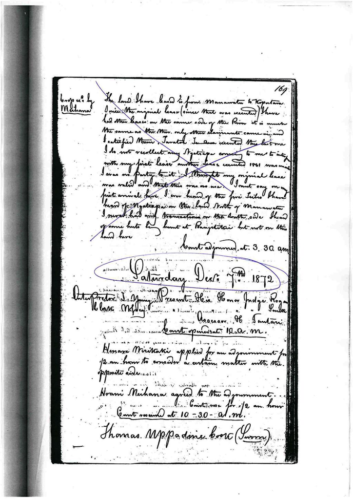
Saturday December 7th 1872
Court opened at 10 am.
Present – His Honors Rogan, Smith, – Judges H. Tautari – Assessor
T. Young – Interpreter W. Grey – Clerk
Henare Wirikaki applied for an adjournment for ½ an hour to consider a certain matter with the opposite side.
Hoani agreed to the adjournment.
Court rose for ½ an hour.
Court resumed at 10.30 am.
Thomas Uppadine Cook – sworn
I live at Foxton – a settler.
I know the land shown on the plan before the court. In the year 1843, about that time, the Ngatiraukawa were the principal people on the block – there were living thence but I understood at the time, they were under subjection to the Raukawa.
Colonel Wakefield purchased land just before I came. I heard of the purchase. I recollect a court held by Spain at Werekino to investigate the purchase.
The Ngatiraukawa chiefs attended. The only objectors to the said purchase was Takaiaporua Moki and others of Raukawa who had received no money.
I never knew of any of the 5 tribes objecting. I have heard land on both sides of Manawatu.
I took the lease on this side in 1864 – from the Ngatiraukawa and Ngatiapa. At the same time Robinson took his last lease from the same parties. The land leased by one on the south side of the river was from Ngatiraukawa alone.
The land I leased had been previously 25 years ago to other parties from Ngatiraukawa.
The first person I remember taking land on the south of the river was Skipworth. He put sheep on the land. It was after Waiorau and Rangihaeata objected. This led to a row between Rangihaeata and Ngatiraukawa.
Eventually the sheep were driven off by Rangihaeata, the Ngatipara of Otaki, Ngatipuri and Ihakara for Ngatiraukawa at Manawatu.
I recollect the being of some houses at Rangitikei either by Rangihaeata or by his orders. The reason was because he objected to the land being let. I can’t say who had leased the land on which these huts stood.
Ngatiraukawa leased the land to Skipworth (by a man named Otaki).
Crop exd by Hoani Meihana
The Ngatiraukawa invited me to settle on Manawatu and gave me some land. I did not know of the tribes being here then. I heard afterwards that Rangitane and others were settled here.
I remember hearing of the interruption of the survey of Wakefields purchase but by what tribes. I don’t know, it was a light for the survey went on. Wakefields purchase was from Manawatu to Horowhenua and then up to the mountains.
I had been here about 2 years before Spains signing took place.
I never heard that Raukawa sent a notice to Muaupoko, Rangitane and Ngatiapa to attend this enquiry. I have only heard of late years of these tribes sending in claims for the parts they settled on – probably within these last 10 years.
I have heard of the dispute of Horowhenua. I heard that the Ngatiapa in conjunction with the Ngatiraukawa sold the land from Rangitikei to Manawatu.
The Awahou block was sold by Ihakara. I heard of the sale of the block Awaturanga by Hirawanu. I am not aware of Hirawanu having claind the land from here to Porirua.
The Muaupoko interfered with my sheep on the south of the river. They pounded some for trespass. This was some 6 or 7 years. The sheep went beyond the boundary of the land I had leased from Ngatiraukawa.
Re-exd by Wirikaki
I have always considered H. Meihana a leading man in the Rangitane. Rangitane never came and objected to my leasing on the south of the river.
The principal tribes who occupied the land from Kukutariahi to Manawatu was the Ngatiraukawa, a few Muaupoko lived at Horowhenua.
Wiremu Tamihana Te Neke – sworn
I live at Waikanae. I am Ngatiawa.
I know the land described on the plan now before the court. I have heard the evidence given by Ihakara Matini, Henare Herekau and I agree with it. I was not present at the fight at Waiorua but I heard of it.
Crop exd by Meihana
The Ngatiawa and Ngatitoa have mana over this land from Kukutauraki to Taiwhakatupua and they have mana still over the land.
I heard Henare Herekau denied that Ngatiraukawa or Ngatitoa had any mana over this land. I object to what he said about that.
Matini made a mistake in putting the name of Ngatitoa over the other tribes. He made a mistake.
By assessor
When Watanui came down, he found living at Horowhenua, the remnants of Muaupoko. I did not hear that Watanui made a peace with Muaupoko and Rangitane.
This closed the whole of the Ngatiraukawa case.
Hoani Meihana applied to have Huru recalled in order to crop examine him on same point left out of his crop examination yesterday.
Hari Wirikaki opposed this and stated that it was wholly out of procedure and irregular after the case had been closed to recall one of their witnesses for crop examination.
The court stated that if the questions Hoani Meihana wished were to be put down on paper and submitted to the court. It would then decide as to whether they would accede to the application.
Questions were submitted for inspection.
The court decided that the questions submitted were not of such a nature as to warrant Huru being recalled for crop examination.
His Honor Judge Rogan
Wished to put a question to Huru which he had forgotten to put yesterday.
James John Dennan – sworn
I am a licensed surveyor under the Native Lands Acts.
The boundaries of the land I surveyed, was from the mouth of the Otaki. I traversed up some 9 miles but was unable to connect the traverses. I came up then, all the way to Manawatu. I traversed it in part.
I erected the pole which stands there at the mouth to show the boundaries of the Muaupoko. I surveyed from the mouth to the Tararua Range. The lines are given by bearing. I surveyed a block lying between the Otaki river and the Waha o Te Marangi. In some cases I received opposition from the natives only portions of the land were pointed out to me.
William Henry Von Alsdorf – sworn
I am a licensed surveyor.
I started from Rotopiko and fixed the boundary shown, done by Mr. Stewart on to Arawaru (Trigs) then pin point Pukomorimori with Hoani Meihana pointed out the boundary. I was to start from Tuwhakatangarua to the swamp and then to the boundary fixed by W. Stewart. This finished the claim of Rangitane as pointed by Meihana.
Ngatiraukawa started one from Mangawharawhara to Otaneputa along a line surveyed by T. Stewart to Manawatu and thence to.
I shifted camp to the Miri and got the boundaries from Ngatiwhakatere starting from Otaneputa to Ngapukuru following the line of Stewarts.
The boundary of Awaturanga block from there in a straight line to Arawaru. I commenced traversing Otauru to Opapa and from thence to the Tararua.
There was two Ngatiwhakatere there with me – Wiriama and Turongo. They were appointed by them to show the boundaries. There was no dispute.
Ihakara’s south boundary commences at Pikautai and from thence to Kirarui thence to Arapaepae and a straight line to Pukemorimori.
After the finish of the survey, the Ngatihuia made some objection and I put the line as they wished. The claim of Kararainas coloured pink is a survey of Knowles.
I came to Wairaraua and surveyed the Ngatihuia boundary commencing from Wairarauwa to Watuhirua turns to Kaikai thence to Ngakuta from thence to Te Ruapaua and from there Poarangi and follows Kararainas claim to Kereru and from there to Arapaepae and from there in a straight line to the Tararua Range from there Ngatakunia and from there Parekauwai and thn to Namana and thence to Wairarauwa I surveyed Roarirahukiki’s clain and Ngatipari.
James Thomson
I am a licensed surveyor under the Native Lands Acts.
The first claim I surveyed was from Kukutauraki to Ngarara, Miri thence to Pakiore Tararua. Kukutauraki traversed along the bush to Waitaheke and showed a Muaupoko boundary going inland thence to Mukukai thence up to Tararua. Heta was with me. K traversed along to Ohau and from there up the river to Makaikatea.
Hakiri commences there it goes up the Ohau to Makaritu thence to Tararua in a line due east. Roira commences at Peho thence east and to Whareau thence to Pukeatua Ohau thence to Tararua and thence to Kare au Kateka thence to a point on the Ohau called Kawhatimana thence along the Ohau to Pukutewea and thence to the beach.
Court adjourned at 3.15 pm.
Identification
- Date
- December 7, 1872
Creation
- Created By
Object rights
- License
- Attribution + Noncommercial + ShareAlike