6 February 1869
- Description
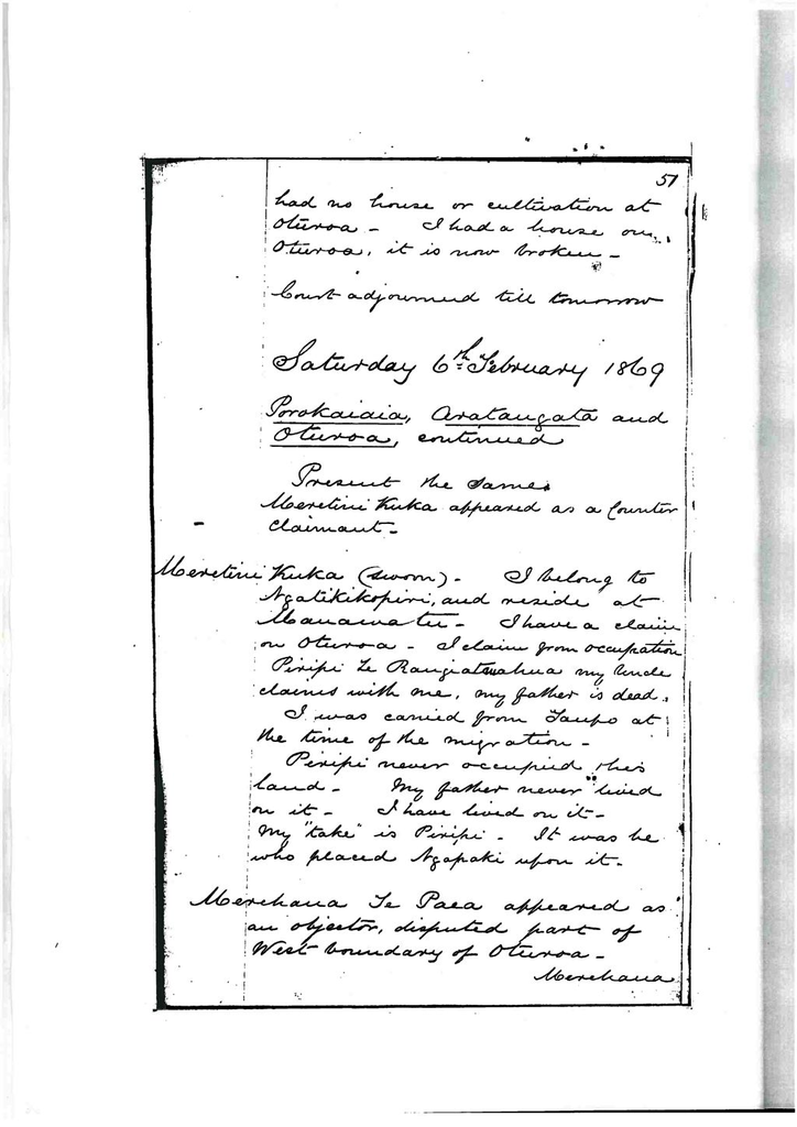
Saturday 6th February 1869
Porokaiaia, Aratangata and Oturoa continued
Present – the same
Meretini Kuka appeared as a counter claimant.
Meretini Kuka – sworn
I belong to Ngati Kikopiri, and reside at Manawatu. I have a claim on Oturoa. I claim from occupation.
Piripi Te Rangiatauahua my uncle claims with one, my father is dead.
I was carried from Taupo at the time of the migration.
Piripi never occupied this land. My father never lived on it. I have lived on it. My ‘take’ is Piripi. It was he who placed Ngapaki upon it.
Merehana Te Paea appeared as an objector, disputed part of west boundary of Oturoa.
Merehana Te Paea – sworn
I belong to Ngati Raukawa and live at Ohau. My father Te Paea and Hukiki owned the land to the west of Oturoa. The east boundary of our land was pointed out to me by Hukiki.
My boundary commenced at a point on the Manawatu and rau in a straight line to a little to the east of Te Totara (pointed out on map).
This was an old boundary to separate the lands of my relative Hukiki from the lands of my relative Whatanui.
Mr. Simmons went to live on Oturoa on the land of Ngapaki and Whatanui (48 to 52).
I then first heard of this boundary but I believe it had been laid off long before that by the old people.
Xd by Mr Nicholson
I have an elder brother named Te Puke. I have never had a house on the part of claim, none of us had.
Te Roera (Hukiki’s son)
I know the east boundary of Hukikis land. It was laid down by my father Hukiki to divide his land from the land of Whatanui. The boundary commenced at a point on Manawatu a few chains above George Myes house (pointed out on map) ran along a ditch to a hill (pointed out) and thence to a place to the east of the Totara (to an angle on the map). This line was laid down by Hukiki about 1845. I was present at the time.
Te Whatanui was present and helped to lay it off.
Meretini has claimed a part of the land, but the land given to Cooks (her husbands) children was given by Hukiki.
Mr. John Knowles
I am a licensed surveyor. I made the survey of the land shown on the map before the court. The survey has been made in accordance with the rules issued by the chief judge. The lines have all been cut on the ground and the angles pegged. Whatanui and a number of natives pointed out the boundaries.
Mr. Cook has a grant of land which is shown on the map, it overlaps a portion of the land before the court.
It does not interfere with any other crown land. This land is included in the land set forth in the second schedule to the Native Lands Act 1867, both Aratangata and Oturoa. I have no charge for survey.
Kararaina recalled said that she and Tauteka were the only owners of the part of the block called Aratangata, and that they had land elsehere besides this.
Rahera stated that she had no land except Oturoa.
Judgement given.
Claimants recognized on Oturoa.
Kararaina Whawha, Tauteka, Rahera Ngapaki, Pareraukawa.
Claimants rejected.
Matene Te Whiwhi, Meretini Kuku.
West boundary of Oturoa to be altered, line to run from A to B. to C to D as marked on the plan.
Ordered that a certificate of the title of Kararaina Whawha, Tauteka, Rahera Ngapaki, and Pareraukawa to a piece of land called Oturoa containing acres be made and issued to the governor to be issued when boundary line is altered and map approved. To be made inalienable by sale.
Fees charged Invest £1 Cert £1 Cr Gt £1 Total £3
Ordered that a certificate of the title of Kararaina Whawha to a piece of land called Aratangata containing 1754 acres be made and issued to the governow without restrictions.
Fees charged Invest £1 Cert £1 Cr Gt £1 Total £3
Both the above pieces included within the boundaries set forth in the second schedule to the Native Lands Act 1867.
Parikawau – a79 – r1 – p10 – at Manawatu
Claim read – map produced
Te Ranginui (affirmed)
I belong to Ngati Parewahawaha and reside at Wharekawa.
I am the owner of the land shown on the plan before the court. Others of my tribe claim with me.
The owners are Te Ranginui Te Katene, Hakopa Te Tehe, Hare Rewiti Rongorongo and Ema te Mahauariki.
This piece of land which we took possession of when we migrated to the district from Taupo. We have lived on it ever since. We have houses and cultivations on the land, and our dead areburied on it. Our title is not disputed. We are in undisturbed possession now. There are no other claimants. We have land elsewhere to live on should we sell this. We wish no restriction to be placed on it.
Te Katene orroborated the above evidence.
Mr. John Knowles – sworn
I am a licensed surveyor. I made the survey of the land shown on the plan before the court. It has been made in accordance with the rules, the lines are all cut on the ground and the angles pegged. It does not interfere with any granted land.
The boundary was pointed out by Ranginui. There was no opposition to the survey.
I have no claim for survey. This land is included in the land set forth in the second schedule of the Native Lands Act 1867.
No objectors appeared.
Ordered that a certificate of the title of Te Ranginui Te Katene, Hakopa Te Tehe, Hare Reweti Rongorongo and Ema te Mahauariki to a piece of land called Parikawau containing a79 – r1 – p10 be made and issued to the governow.
In second schedule to the Native Land Act 1867.
No Restrictions.
Fees charged Invest £1 Cert £1 C Gt £1 Total £3
Awahou Bolck
Map produced.
Hare Reweti stated that this was a reserve out of the Awahou, and, that his Tuakana Te Teira held a crown grant for it.
The reserve had been surveyed by Mr. Stewart after the purchase of the Awahou block.
Mr. Charles Simmons stated that he knew the land shown on the plan. It was a portion of the Awahou purchase. A crown grant had been issued for it, he had seen it. It was then in the possession of the Reverend Mr. Duncan of Manawatu.
Hare Reweti stated that the grantee Te Teira was dead. Advised to send in a claim succession to hereditaments – Dismissed
Ngawhakaraua – 76 acres
Claim read – Sketch map produced
Hoani Meihana – sworn
I belong to the Rangitane tribe and reside at Manawatu. I recognize the land shown on the map before the court.
This land is owned by me and the others in my application.
Manawatu has always been the permanent residence of the Rangitane tribe.
We derive our title to this land from ancestry and occupation. My houses were not on this portion of our land but my cultivations are on it. We commenced to cultivate it in 1856. My title to this land is not disputed but Ihaka and Horima Mahoe dispute the right of my co claimants. The claimants with me are Horima Mutu, Karanama, Renata and Hamahanga. I do not claim on this particular piece, my land is outside.
Ihaka Te Rangimamiora appeared as an objector.
Ihaka Te Rangimamiora – sworn
I belong to the Rangitane tribe and reside at Manawatu. I recognize the land shown on the plan before the court.
I oppose the claim of Horima and party to this land, they have no right to it. This lands belongs to me, and to those who claim with me. We claim from our ancestor Tireo, we are descended from him. The Maikuku o Rangiwetea is a Kahikatea tree where Rangiwetea a descendant of his used to snare tuis.
Okurere is a swamp on this land where Rangiwetea used to catch ducks and fish.
The Pukuo Marohi is a place where my ancestor Marohi used to get ducks and Kahakaha (small fish). My ancestor used also to snare tuis on the land.
My ancestor gave a hakari on the land, it was called Tuikaitarakihi, the birds were snared on the land, the hakari was given to the ancestors of the claimants in payment for food given by them to my ancestors. They did not give a return hakari to my ancestors.
The land on this map belonged to my ancestor only, the land of the claimants is outside of this block. My ancestor lived on this land until my time.
My father had a house and cultivations upon it. I lived on and had a house on it, it and my fences andcultivations are on it now. The house and fences are still standing and could be shown. Those who claim with me are Te Peiti, Horima Mahoe Kerie, Rota, Te Tutere. These have all lived on the land and claim with me from a common ancestor.
Court adjourned till Monday.
Identification
Related items

Creation
- Created By
- Unknown
Object rights
Taxonomy
- Community Tags
Related items